Geospatial solutions for land administration
Company email contact Company telephone contact

Smarter Land Administration starts here

We combine geospatial technology with modern land administration workflows to deliver efficient land governance solutions across Africa.

We are based in GhanaWith Local knowledge for international delivery
Geospatial Software Development with Advanced Spatial Intelligence

We demystify the complexities of geospatial data through innovative software solutions.

NSG

Digital Land Administration Solutions

Live
Preparing parcel intelligence…
Select a parcel
Available Allocated Registered Verified Reserved Review
Guided map tour Full Layout
1 / 5
1,239 mapped parcels
Parcel intelligence ready
Selected parcel NSG-P105
Area 0.26 acres
Status Ready
Allottee
We Built for:
Traditional Authorities
Customary Land Secretariats
Local Government
Estate Agencies
WHAT WE DO

Geospatial Solutions for Modern Land Administration

01

Digital land administration

End-to-end geospatial solutions for modern land administration and governance

See the system →
02

GIS consultancy

Spatial analysis, database design, data preparation, web maps and decision-support tools built around your work

Discuss a need →
03

Geospatial software development

Purpose-built desktop and web applications that turn maps into usable systems

Build with us →
04

Surveying & mapping

Boundary, topographic, engineering and cadastral surveys

Plan a survey →
05

Remote sensing

Satellite image analysis for land cover, development monitoring, environmental studies and planning.

Explore an application →
06

Photogrammetric surveys

Drone capture, orthomosaics, elevation models, 3D surfaces

Scope a flight →

The Problems?

Many land institutions still depend on fragmented records and manual processes, making it difficult to manage parcel information accurately, efficiently and transparently.

1

Missing Records

Important land records may be missing, damaged or incomplete.

2

Double Allocation

The same parcel may be allocated to more than one person.

3

Difficult Parcel Location

Parcel information can be difficult to locate within scattered files and maps.

4

Slow Record Retrieval

Manual searches make record retrieval lengthy and inefficient.

5

Revenue Leakages

Weak tracking systems can result in unrecorded payments and lost revenue.

6

Land Disputes

Unclear boundaries and ownership records frequently lead to disputes.

7

Limited Transparency

It may be difficult to determine who performed an action or approved a transaction.

8

Poor Record Preservation

Paper-based documents are vulnerable to deterioration, loss, fire and unauthorised alteration.

9

Weak Transaction History

Historical allocations, transfers and ownership changes are difficult to track.

The Solution?

A Digital Land Information System that centralizes parcel records, maps, transactions and documents into a single platform.

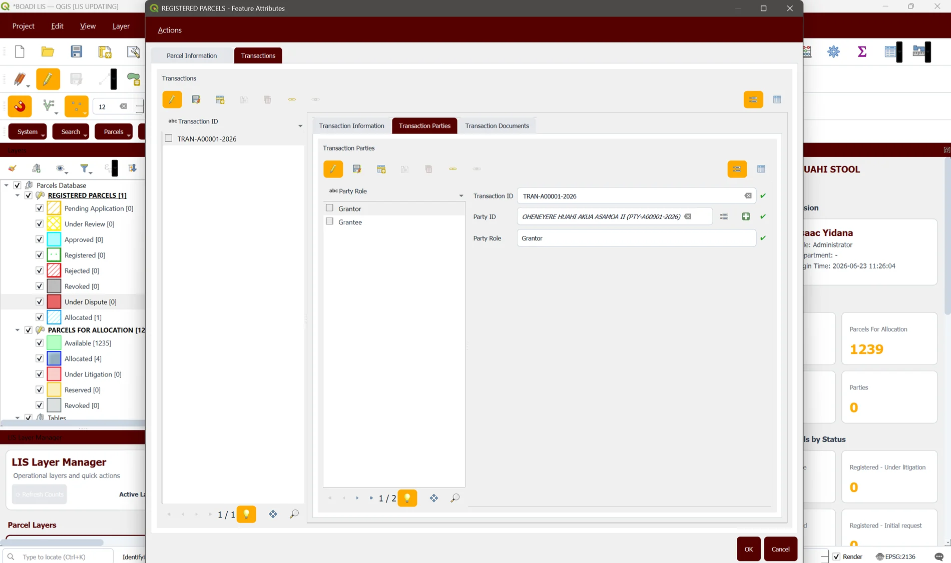
Centralized digital parcel database
Interactive GIS-based parcel maps
Allocation & registration workflows
Automated document generation
Transaction tracking & history
QR-code verification of records
Digital archive of documents
Reporting & analytics dashboards
Secure & searchable records
Audit trail & user management
Site plan generation
Certificates & allocation notes generation
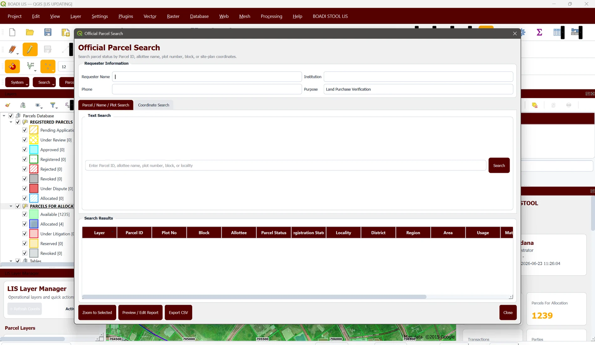
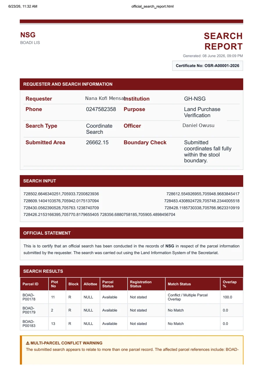
Official parcel search
Request a demonstration
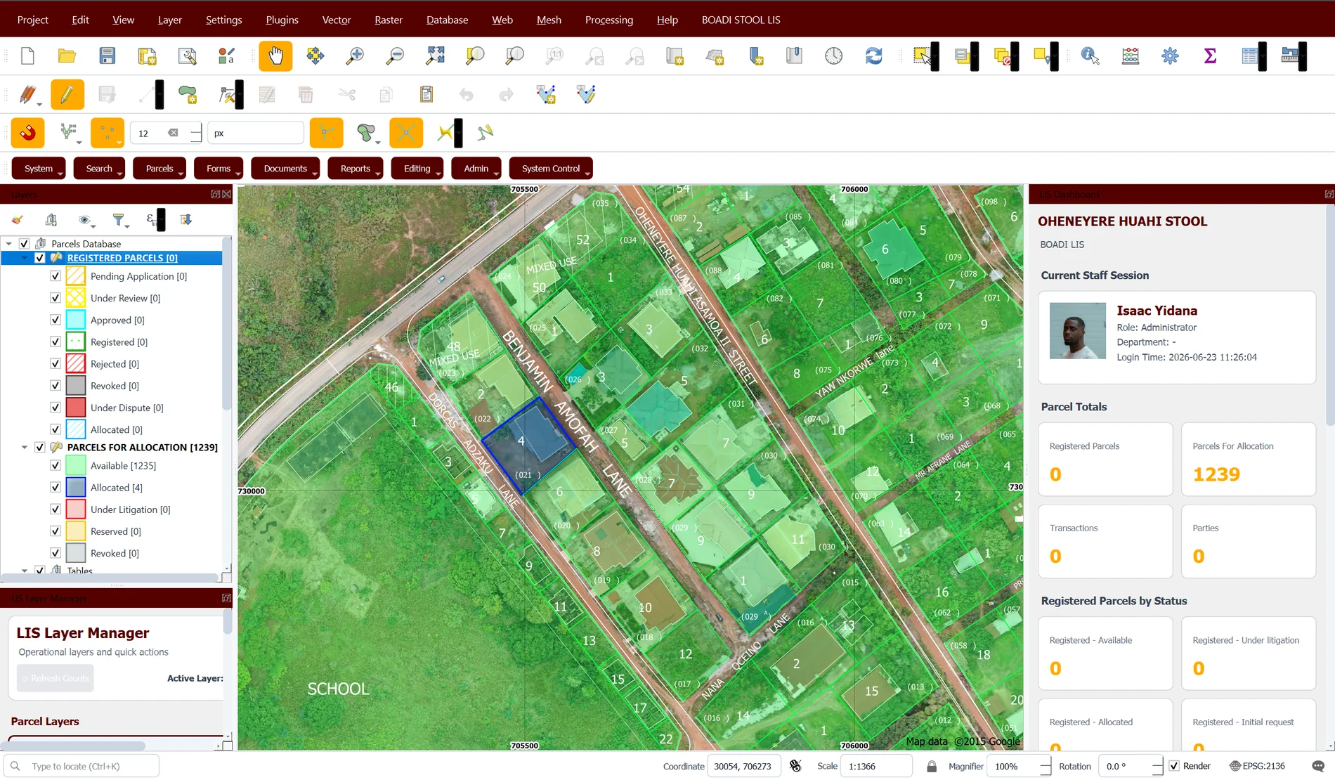
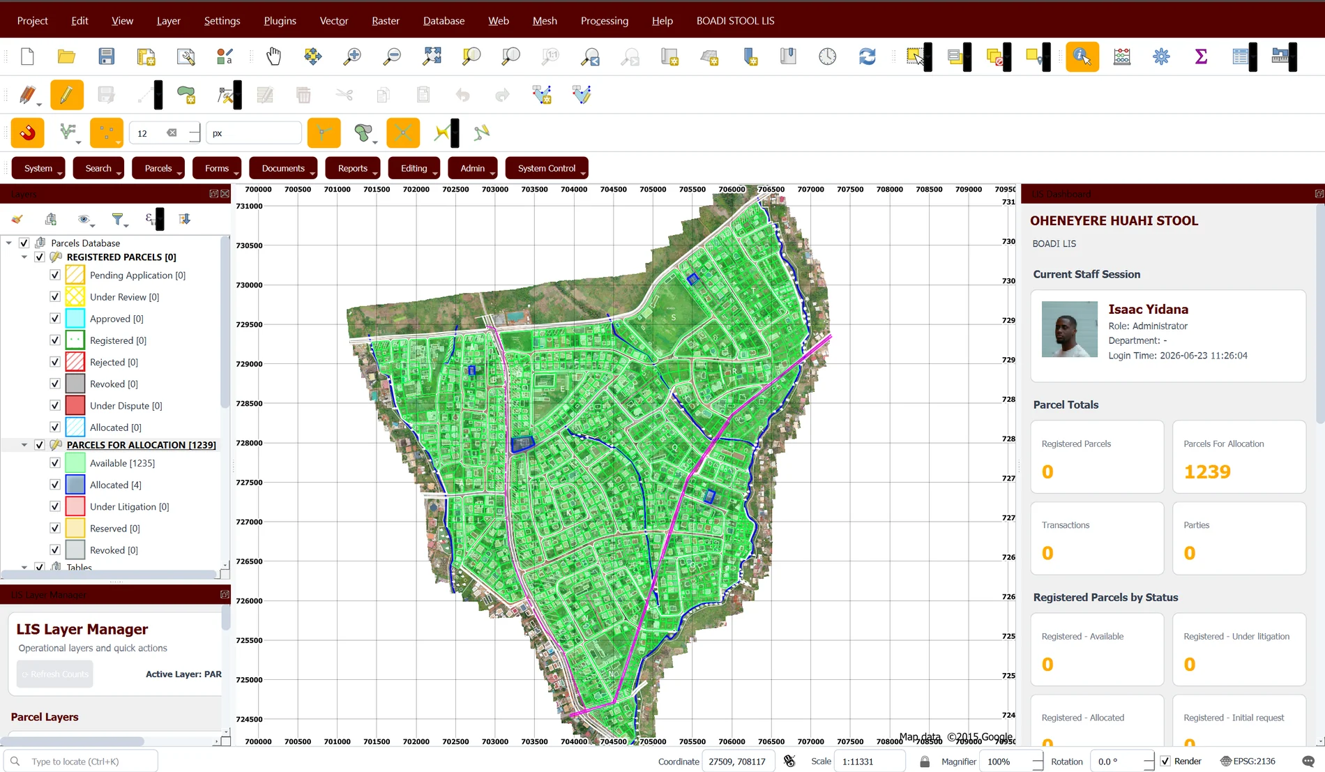
Dashboard Overview
LIS dashboard overview
LIS dashboard analytics
Official parcel search interface
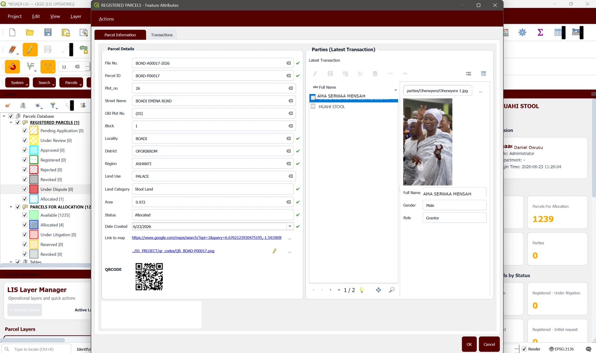
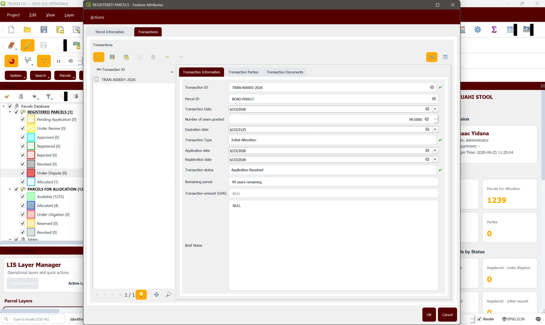
Parcel registration interface
Registration workflow applicant details
Registration workflow parcel details
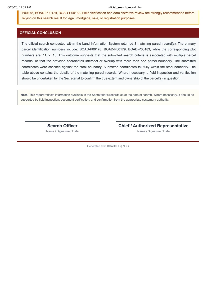
Land search report preview
Official land search report output
SAMPLE OUTPUTS

Generate documents from parcel data

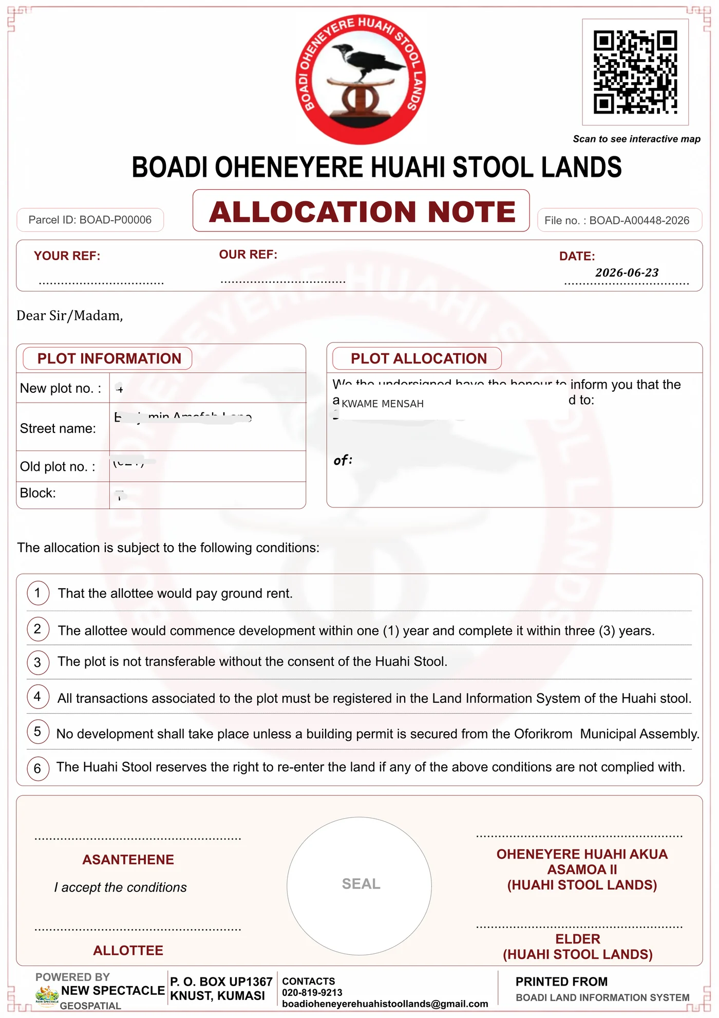
The same trusted parcel record can produce allocation notes, certificates, site plans and official search reports.

Sample allocation document
Allocation records
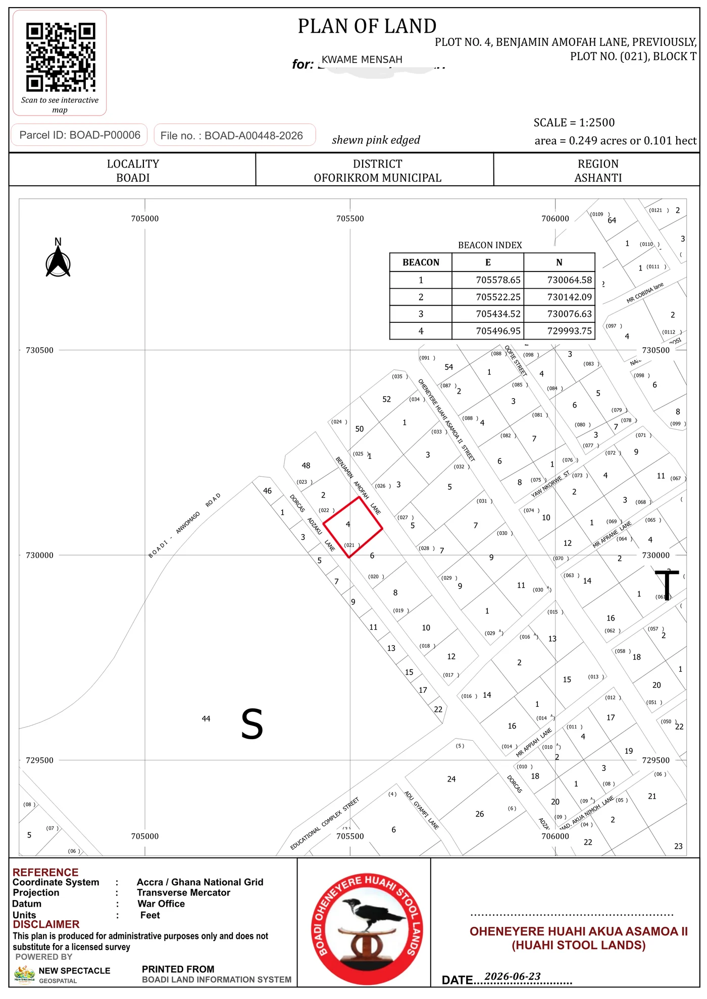
Sample site plan
Site plans
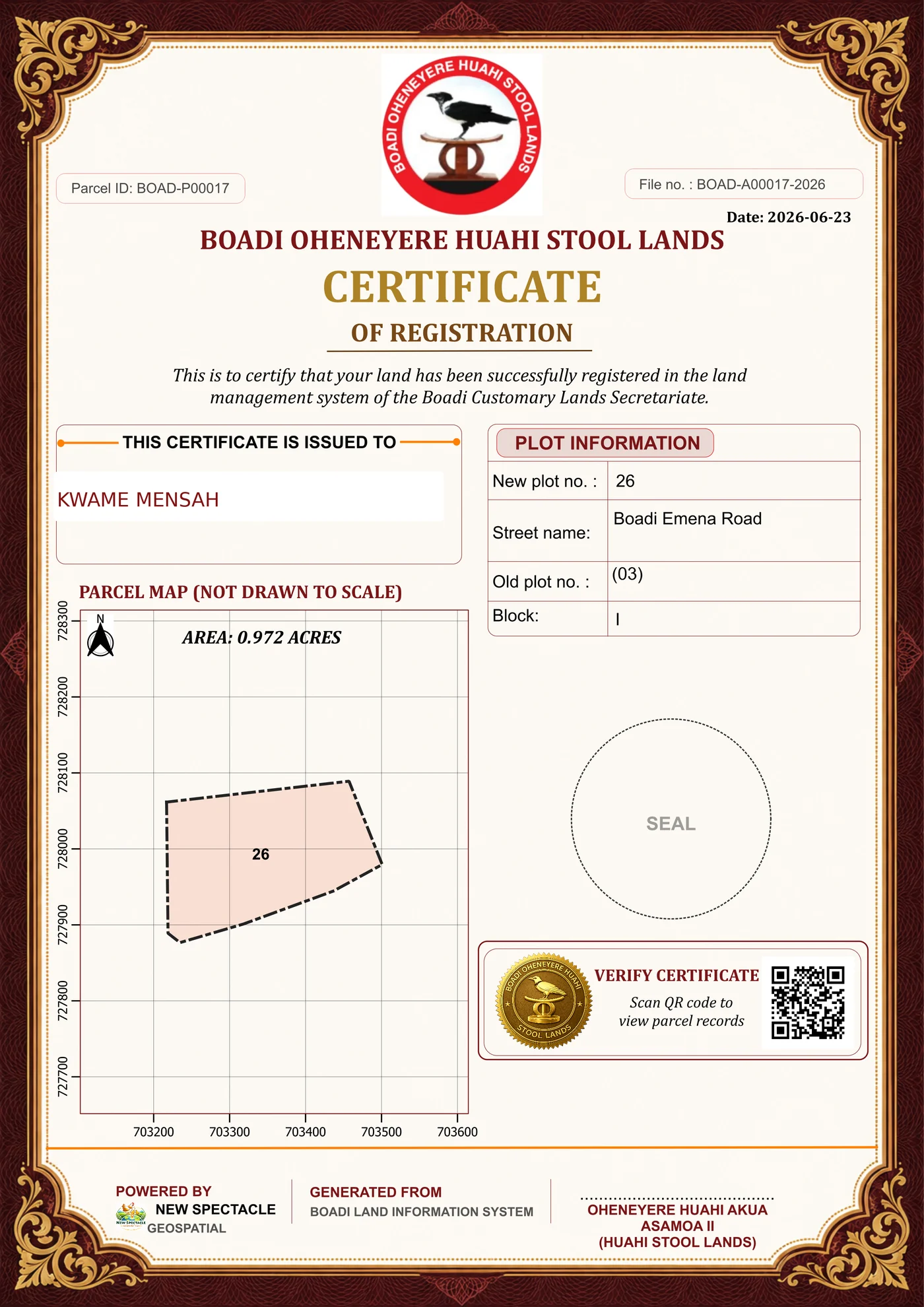
Sample land certificate
Reistration Certificates
COMMON QUESTIONS

What clients usually ask before we begin.

Every assignment is different, but these are useful starting points.

Can you improve an existing GIS or parcel database?

Yes. We can review the current structure, clean and migrate data, improve forms and reports, and introduce a more maintainable workflow without discarding useful work.

Do you only build systems for traditional authorities?

No. The same methods can support customary land secretariats, assemblies, public institutions, estates, developers and organisations managing property or spatial assets.

Can the system work offline or in areas with poor internet?

Yes. Deployment can be designed around desktop, local network, cloud and field components depending on connectivity, staffing and security needs.

Do you provide training and documentation?

Yes. User training, workflow documentation and technical handover are treated as part of implementation, not as an afterthought.

LET'S TALK

Tell us what you are working on

Share the problem, the data you have and the outcome you need. We will respond with a practical next step.